


Vue complète
Articles similaires
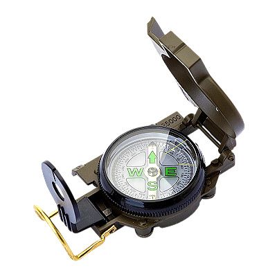
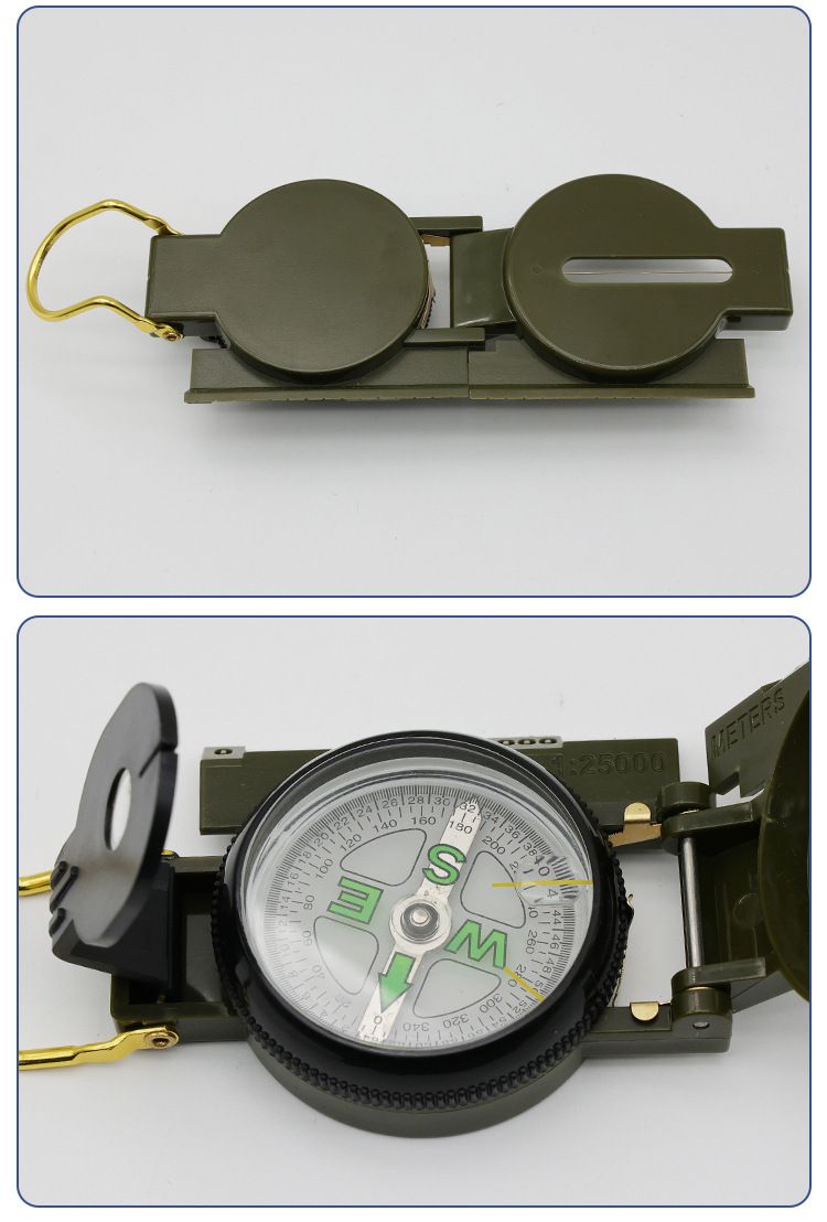
Boussole d'escalade portable en plastique vert armée avec couvercle rabattable pour camping et extérieur
575 vendu
10,82€16,43€
Défaut : défaut

Quantité :

Rapport
Inclure la violation du droit d'auteurLivraison standard gratuite. Voir les détails
Estimé entre Thu, Oct 16 et Mon, Oct 20
Vous pouvez retourner le produit dans les 30 jours suivant sa réception. Voir les détails
Achetez en toute confiance

Garantie de remboursement
Récupérez l'article que vous avez commandé ou soyez remboursé. Apprendre encore plus
À propos de cet article
Le vendeur assume l'entière responsabilité de cette annonce.Numéro d'article: 30790560
Caractéristiques des articles
Description de l'article par le vendeur
How to Use the Multifunctional Compass
(1) Determine the Orientation:
1. Determine the local southeast and northwest directions
(1) Open the compass to set the azimuth indicator△Align to 0;
(2) Rotate the compass until the magnetic needle points to the north end and aligns with 0. The direction it points to is north, and you can directly read the east, south, west, and north directions on the azimuth glass.
2. Calibrate to the nearest thousandth
Calibrating map orientation involves using a compass to align the map's orientation with the actual location.
(1) Turn on the instrument and adjust the dial base so that the azimuth indicator△Align to 0;
(2) Use a surveyor's tape to align with the true meridian on the map;
(3) Rotate the map so that the north end of the magnetic needle points to the value of the magnetic declination in this region, then the orientation on the map will be completely consistent with the current location.
3. Determine the magnetic azimuth angle
A. Determine the magnetic azimuth angle of the target on the map
(1) Use a compass to calibrate the map and keep it stationary
(2) Make the surveying tape perpendicular to the line connecting the reference point and the target point, adjust the dial base so that the indicator..△Align with the zero mark
(3) After the magnetic needle comes to rest, the scale on the dial base pointed by its north end indicates the magnetic azimuth angle value from the starting point to the target point.
B. Determine the magnetic azimuth angle of the target on-site
(1) Turn on the instrument and align the slot indicator△Align it to 0 and make sure the reflector is slightly at a 45-degree angle with the dial base
(2) Insert your thumb into the lifting ring, hold the instrument flat, and aim at the target using the sight and crosshair
(3) Look at the magnetic needle from the reflector at the alignment on the dial base, which is the magnetic azimuth angle value for the target on-site
Box size 40.5*26*28.5CM, one box contains 144 pieces, weight 13KG


Recherches associées
couverture thermique pour le campingles deux couteaux tactiquestrousse médicale de survie antibiotiquescamping allume-feuensemble de couteaux tactiquespelle de surviebâton extensiblecouteau de poche tactiquecouteau tactiquecouteau de botte tactiqueKit de survie pour 2 personneséquipement de survie tactiquecouteau tactique EDCéquipement de survie arctiquekit de survie pour voiture en hiver
 4.3 sur 5 sur la base de 6,260 avis